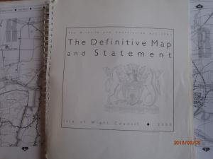
Definitive Map and Statement
Definitive Map and Statement History
In 1949 all county councils in England and Wales were given the duty of surveying and mapping all public rights of way in their area. They needed to classify them as footpaths, bridleways or roads used as public paths. These are now called byways open to all traffic (BOATs). The surveys had three stages: draft, provisional and definitive. The definitive maps would be taken as conclusive evidence that a path shown was a public right of way at the date the map was prepared. A statement in respect of each path recording particulars was deemed to be conclusive evidence of such matters recorded therein on the position, width, conditions and limitations.
The original definitive map for the Isle of Wight was produced in 1952 and reviewed in 1968. The current edition of the Definitive Map and Statement for the Isle of Wight has a ‘relevant date’ of 29 February 2000.
The Isle of Wight Definitive Map and Statement 2000
The Isle of Wight Definitive Map 2000 is based on the Ordnance Survey 1:10,000 map for the Isle of Wight.
The map is available for inspection at:
The following are the pages which precede the maps in the printed Definitive Map & Statement book.
01 Front Cover
02 Second Page
03 Contents
04 Introduction
05 Definitive Map & Statement Recording Public Rights of Way
06 Legal Effect of the Definitive Map & Statement - Part III Section 56
07 The Relevant Date Section 52(2) a & b - Section 57(4)
08 Continuous Review Part III Section 53 - future modifications of the map & statement
09 Modification Orders & Application Section 52(2) Schedules 14 & 15
10 Key to Rights of Way & maintenance of paths
11 Path Numbering - urban & parish boundaries
12 List of page numbers & main place names
13 Key Plan of Map Pages
14 The maps
The map is for public inspection and reference only and must not be copied without permission of the owner.
The Definitive Map and Statement is conclusive proof of the existence and status of a right of way at the relevant date (29 February 2000). Where the map shows a footpath, bridleway or byway, the map is conclusive evidence that there was at the relevant date a highway as shown.
The Definitive Map and Statement may only be changed by and according to an Order made by the Council. The Council has a duty to continuously review and update the Definitive Map and Statement so it forms an accurate record of the public rights of way network.
The Isle of Wight Definitive Map and Statement is divided into the 20 parishes which existed in 1952. Each public right of way is numbered and identified with the parish prefix initials e.g. BS100 is path number 100 in the parish of Brighstone. The parish prefix and number system is the Council’s way of identifying all of the paths on the island. You will find this path number on most of the signs that show the rights of way network.
(A) Arreton; (B) Brading; (BB) Bembridge; (BS) Brighstone; (C) Chale; (CB) Calbourne; (CS) Cowes; (F) Freshwater; (G) Gatcombe; (GL) Godshill; (N) Newport; (NC) Newchurch; (NT) Niton & Whitwell; (R) Ryde; (S) Shalfleet; (SS) Sandown & Shanklin; (SW) Shorwell; (T) Totland; (V) Ventnor; (Y) Yarmouth.
The online digital definitive maps can be viewed on our Digital Definitive Map web page. The relevant date for this map is 29 February 2000. Changes have occurred to the rights of way network since this date. For example by diversion or extinguishment orders. For details of changes please view the current definitive map changes list. If you would like more information regarding any of the changes, please email rightsofway@iow.gov.uk.
The viewing of the Digital Definitive Map 2000 must not be used in substitution of obtaining a Local Land Charges Search (optional question 5.1), the result of which will provide the accurate situation taking into account changes to the rights of way network since 29 February 2000.
Section 31 Deposits and Register
To prevent members of the public creating new rights of way across land, landowners can deposit with the Council a statement, map and a description of their land and any rights of way crossing it. This is known as a “Section 31 Deposit” as it is made pursuant to Section 31(6) of the Highways Act 1980. Further information regarding Section 31 Deposits generally and how to make an application is set out below:
Public rights of way can come into being having been deemed to be dedicated. This occurs through 20 years’ uninterrupted use by the public giving rise to a presumption that the way was intended to be dedicated as a right of way by the landowner. The period of 20 years is counted back from the date on which the public’s right to use the path was first brought into question or challenged. A Section 31 Deposit is needed to challenge both the public’s right to use a non-definitive path and to show an intention by the landowner not to dedicate new rights of way across their land.
The effect of making a Section 31 Deposit is:
- It is possible to allow continued informal use of a route (e.g. by local people), without fear of a public right of way being claimed on the basis of future use from the date of the Deposit.
- Where a route has been used informally, for less than 20 years, it will not be possible for a right of way to be claimed through deemed dedication (although a claim at common law may still be possible).
- Any new routes will automatically be protected from the outset from the possibility of any claim.
The Deposit will have no effect on the existence of public rights of way already shown on the Definitive Map or on any rights which have already been established before the Deposit i.e. claims based on historical evidence or through 20 years use prior to the first Section 31 Deposit. However, making a Deposit will immediately fix a point at which any unacknowledged rights are brought into question. For subsequent claims, the 20 year period would be counted back from the date of the Deposit. If these claims succeed, the Deposit documents should be revised.
The Council is required to maintain a Register of Section 31 Deposits and details of Deposits are set out below. The Register is available for public inspection at the Public Rights of Way department, County Hall, High Street, Newport, Isle of Wight, PO30 1UD during normal office hours (9.00am – 5.00pm Monday to Friday). Please email rightsofway@iow.gov.uk to arrange an appointment before arrival to ensure a member of staff is available to assist. Please note: our offices are currently closed due to Covid-19 restrictions.
As of 1 October 2013, Statements can be made in respect of either rights of way or village greens, or to cover rights of way and village greens. Statements, but not necessarily the map, will need to be renewed every 20 years in respect of applications made after 1 October 2013 (every 10 years for Statements / Deposits made before 1 October 2013).
For village greens, under section 15A of the Commons Act 2006, landowners can deposit a statement (with map) which brings to the end any period of recreational use ‘as of right’.
Application Process
- Complete the Application for Deposits Form
- Pay a £265 fee to cover the Council’s costs of logging the application, making it available on our website and paper register.
- Renewals have a £65 fee.
- If the map lodged with the application is larger than A3, please provide an electronic copy in PDF format.
If you have any further questions, contact details are as follows:
- s31(6) Highways Act 1980 deposits: Public Rights of Way, County Hall, High Street, Newport, Isle of Wight, PO30 1UD. Email: rightsofway@iow.gov.uk Telephone: 01983 821000
- s15A(1) Commons Act 2006 deposits: Tree Team – Development Control, Seaclose Offices, Fairlee Road, Newport, Isle of Wight, PO30 2QS. Email: trees@iow.gov.uk Telephone: 01983 823893
Current S31 Notices of Application:
Section 31(6) of the Highways Act 1980 deposits - Statements made after 1 October 2013
| Ref |
Address |
OS Grid Ref
|
Date Received by IW Council |
Map |
| CSs31(1) |
Crockers, Rew Street, Gurnard, Cowes, IW, PO31 8NU includes beach chalet, garden, cliff and foreshore to mean high water
|
47086
95363
|
7 April 2014 |
Crockers |
| CSs31(2) |
Norris Castle Estate and Norris Lodge of New Barn Road, East Cowes, IW, PO32 6AZ registered under Land Registry Title numbers IW68975 & IW40341 |
51546
96194
|
28 April 2015 |
Norris |
|
CSs31
(3)
|
Nine various locations within the Barton Manor Estate, Whippingham, IW, PO32 6LB |
|
14 June 2017 |
Barton |
| CSs31 (4) |
Woodhouse Farm, Barton Estate, East Cowes, PO32 6NU |
52530 939 |
25 July 2017 |
Woodhouse |
| CSs31 (5) |
New Barton Farm, East Cowes, PO32 6LD - land laying either side of Mount Road on the Barton Estate & land at Kingston Farm north of Whippingham church |
5294 3613
and
50937258
|
5 September 2017 |
New Barton Farm |
|
CSs31
(6)
|
The Hermitage, Whitwell, PO38 2PD |
449801 / 78843 |
27 December 2018 |
The Hermitage |
|
CSs31
(7)
|
RSPB Nature Reserve - Brading Marshes |
462509 /
87898
|
4 January 2019 |
RSPB |
|
CSs31
(8)
|
Summers Court, Freshwater |
432986 / 86731 |
13 June 2019 |
Summers Court |
|
CSs31
(9)
|
Land at Rowborough Estate, Bowcombe and Hill Farm and Garstons Farm, Gatcombe |
SZ448 862
SZ489 856
|
9 October 2019 |
Rowborough/Hill Farm / Garstons
|
|
CSs31
(10)
|
Land at Fernhill, Wootton Bridge |
SZ544 917 |
9 October 2019 |
Fernhill |
|
CSs31
(11)
|
Papermill Field & Castle Garden Field adjacent to Carisbrooke Castle |
448604/87455 |
01 July 2020 |
Papermill / Castle Garden |
|
CSs31
(12)
|
Combley Farm, Downend |
454437/87625 |
27 July 2020 |
Combley |
|
CSs31
(13)
|
Land at Somerton Farm, Northwood |
SZ495941 |
11th November 2020 |
Somerton 1 |
|
CSs31
(14)
|
Land at Somerton Farm, Northwood |
SZ492943 |
11th November 2020 |
Somerton 2 |
|
CSs31
(15)
|
Gotten Leaze Farm, Calbourne |
SZ425855 |
11th November 2020 |
Gotten Leaze |
|
CSs31
(16)
|
Ashengrove Farm, Calbourne |
SZ443873 |
2nd January 2021 |
Ashengrove |
|
CSs31
(17)
|
Land to the north & south of Steyne Road, Bembridge |
SZ64268759
SZ64528732
|
26th April 2021 |
Thornycroft |
|
CSs31
(18)
|
Calving Close Copse & Land at Medham Farm Lane |
SZ499 938 |
14th December 2021 |
Medham land / Calving Close Copse |
|
CSs31
(19)
|
Land at Apse New Barn Farm, Apse Heath |
56482 / 82843 |
1st January 2022 |
Apse New Barn Farm |
|
CSs31
(20)
|
Land at Apse New Barn Farm, Apse Heath (solar park) |
566/828 |
18th August 2022 |
Apse New Barn Farm (solar) |
|
CSs31
(21)
|
Upper Hyde Farm, Shanklin |
571 / 818 |
18th August 2022 |
Upper Hyde Farm |
|
CSs31
(22)
|
Priory Bay Hotel, Seaview |
SZ6322490320 |
12 September 2022 |
Priory Bay Hotel |
Register of Landowner Section 31(6) of the Highways Act 1980 deposits - Statements made before 1 October 2013
Address or description of land
|
Date first received by IWC
|
Expiry date
|
Map or contact Rights of Way if not on line
|
Perreton Farm, Arreton
|
05 March 2013
|
05 March 2023
|
|
Land at Bayfields, Cowlease Hill
|
27 April 2012
|
27 April 2022
|
|
Original - New Barn Farm, Apse Heath
Declaration - New Barn Farm, Apse Heath
|
31 January 2012
27 December 2016
|
31 January 2022
27 December 2026
|
|
Upper Hyde Farm, Shanklin
|
31 January 2012
|
31 January 2022
|
|
Waters Edge, Pier Road, Seaview,
PO34 5BN
|
13 September 2011
|
13 September 2021
|
|
America Woods, Shanklin
|
15 June 1992
|
28 June 2021
|
|
Old Corn Barn, Main Road, Thorley,
PO41 0SX
|
01 November 2011
|
01 November 2021
|
|
Fort Redoubt, Freshwater Bay
|
15 November 2010
|
15 November 2020
|
|
3 X parcels of land known as: Castle Gardens, Papermill & Little Buck at Froglands Farm, Carisbrooke
|
13 September 2010
|
13 September 2020
|
|
Tapnell & East Afton Farms
|
02 August 2010
|
02 August 2020
|
|
Werrer Farm, Nr Newport / Northwood
|
26 October 2009
|
26 October 2019
|
|
Nodnewel, Pier Road, Seaview, PO34 5BN
|
13 July 2009
|
13 July 2019
|
|
Summers Court, Freshwater
|
04 June 2009
|
04 June 2019
|
|
Brading Marshes
|
16 February 2009
|
16 February 2019
|
|
Cooks Castle Farm, Wroxall
|
27 February 1997
|
9 March 2019
|
|
Nunwell Estate, Brading
|
24 July 2007
|
24 July 2017
|
|
Manor Farm, Wellow
|
21 November 2007
|
21 November 2017
|
|
Land at Rookley Nr Hillcrest Road
|
12 October 2006
|
12 October 2016
|
|
Newclose Farm, Nr Newport / Arreton,
|
29 September 2006
|
29 September 2016
|
|
30 Buckland Gardens, Ryde, PO33 3AG
|
24 May 2007
|
24 May 2017
|
|
28 Buckland Gardens, Ryde, PO33 3AG
|
01 February 2007
|
01 February 2017
|
|
Old Coach House, Calbourne Road, Swainstone, PO30 4HX
|
10 October 2006
|
10 October 2016
|
|
Stables & land adjoining NT120 Bannock Road, Whitwell
|
17 February 2006
|
17 February 2016
|
|
Land at Three Gates Farm, Calbourne
|
07 December 2004
|
|
|
Great Park Estate, Fulford holding & Heathfield Farm, Nr Newport
|
02 December 2001
|
|
|
Part of Westcourt Farm (now part of Northcourt)
|
23 November 2001
|
|
|
Land at Nettlestone (north of Longlands Copse)
|
11 August 2001
|
|
|
Little Atherfield Farm, Shorwell
|
19 May 2000
|
|
|
Bowcombe Estate
|
11 November 1999
|
|
|
Great Park Farm, Newport
|
30 May 1999
|
|
|
Godshill Park Farm
|
08 May 1999
|
|
|
Thorley Manor Farm & Kings Manor, Freshwater / Yarmouth
|
20 April 1994
|
|
|
Land off Perowne Way, Sandown
|
22 February 1999
|
|
|
Downcourt Farm, Whitwell
|
17 April 1998
|
|
|
Land at Marsh Road, Gurnard
|
27 May 1997
|
|
|
Thorncross Farm, Brighstone
|
11 June 1997
|
|
|
Land at and surrounding Scotland Farm, Godshill
|
13 May 1996
|
|
|
Land surrounding Merrie Gardens Farm, Bigbury Farm, Batchelors Farm, Rill Farm, Corve Farm Chale, Rookley Green and land at Billingham
|
09 November 1995
|
|
|
Eades Farm, Newbridge
|
19 June1995
|
|
|
Harbour Farm, Bembridge
|
02 October 1992
|
|
|
Brighstone Forest
|
13 January 1994
|
|
|
Moor Farm, Godshill
|
28 June 1993
|
|
|
Land at and near Ashengrove Farm, Calbourne
|
28 January 1993
|
|
|
Roadway adjacent to Fishbourne ferry terminal
|
24 February 1992
|
|
|
Briddlesford Estate, inc Fernhill & Littletown
|
03 June 1992
|
|
|
Path at Rew Down, Ventnor
|
04 April 1992
|
|
|
Randalls Passage, 32 High street, Ventnor
|
12 March 1992
|
|
|
Land adjacent to N218 and Medina Link Road
|
23 March 1989
|
|
|
Modification Order Applications and Register
A Modification Order changes the Definitive Map and Statement in one or more of the following ways:
- By adding a footpath or bridleway (public path) or a byway not previously recorded on the Map and Statement.
- By deleting a public path or byway previously shown on the Map and Statement.
- By altering the status of a recorded path or byway (e.g. by upgrading a footpath to a bridleway).
- By amending the details of position or width of a path or byway which are recorded in the Statement.
An application can be made to the Council for a Definitive Map Modification Order and provided it is correctly made and supported with sufficient evidence, the Council has a legal duty to investigate and decide whether a Modification Order should be made. The whole basis for making Definitive Map Modification Orders hinges on there being sufficient evidence that the Definitive Map and Statement is incorrect and needs to be modified. It is essential to realise that no matter how desirable a change or modification may be, the Council cannot make an order as applied for unless there is sufficient evidence. If you wish to make an application then please contact the Rights of Way department and request an application pack which will provide full details of the procedure and include the necessary application forms.
Pursuant to the Countryside and Rights of Way Act 2000, the Council is required to keep a Register of Applications made under Section 53(5) of the Wildlife & Countryside Act 1981 and to make it available for public viewing.
View the Modification Register