Current Closures
Details of roads (tarmacked carriageway and footways/pavements) closed temporarily for repair/maintenance can be found on the Islands Roads website.
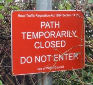
How to temporarily close a public right of way
If you wish to apply to temporarily close a public right of way in order to undertake works on or near the path you will need to contact the Public Rights of Way service to discuss the closure. Please contact the service by email rightsofway@iow.gov.uk or if it is an immediate emergency due to unforeseen safety reasons call 01983 821000 (9am to 5pm weekdays).
There is a process to follow which will includes:
- The completion of a formal application form;
- Payment of a fee;
- You or your contractor will need to install and maintain the on site notices, closure signs and / or barriers for the duration of the works.
The Tennyson Trail - Byways permanently closed to motor vehicles
This is a series of Byways that are permanently closed to vehicles from Carisbrooke to Freshwater Bay (Public Byways N123, N128, N136A, N139, BS4, BS10, BS44, S26, BS53, F33). They are permanently closed to vehicles pursuant to The Isle of Wight Council (Tennyson Trail, IW (Prohibition of Driving) Order No 1 2006.) View a map of the closed route - Tennyson Trail, Byways (PDF, 3.47MB, 1page)
Permit scheme for blue badge holders
A permit scheme is available to blue badge holders, licensed hackney carriages (taxis) and community vehicles between 1 April and 30 September annually.
Application Process
- To apply for a permit please download and complete the Tennyson Trail Permit application form. (PDF, 4 pages, 33KB).
- Please include a photocopy of your blue badge permit with your completed application form.
- Send the completed application form to: Public Rights of Way, County Hall, High Street, Newport, Isle of Wight, PO30 1UD or email a copy of the completed form to rightsofway@iow.gov.uk
For further information or guidance please contact Public Rights of Way by completing the online send a message to service form, alternatively find our contact details in the 'Contact' tab above
Byways - Motor Vehicle Closure
Please note: the annual temporary winter motor vehicle byway closure has come into force from Friday 7 October 2022 and is anticipated to be required until the end of March 2023. The purpose of this is to try and protect the unsealed surfaces from damage over the wet winter months. The closure is only for motor vehicles not walkers, cyclists or equestrians. It doesn't apply to landowners who need to drive to and from their land or property situated along the closed parts of the byways.
The byways closed to motor vehicle are:
Arreton:
A25 (Great East Standen Lane) between its junctions with Burnt House Lane and Public Byway A28.
A28 (St George’s Down) between its junctions with Arreton Cross and approximately the entrance into Newport Golf Club off St Georges Lane.
Bembridge
BB37 (Peacock Hill) from its junction with the B3395 Sandown / Bembridge Road to a point approx 400 metres south of Hillway Road
Brading:
B13 (Galleyhorn Lane) from its junction with Byway B14 to its junction with byway R63 (Attrills Lane)
B14 (Galleyhorn Lane) from its junction with Byway B15 / B15A to its junction with Byway B13
B21 (Ricketts Hill) from its junction with West Lane to its junction with Rowborough Lane
B33 (Kern) from its junction with Kern Lane to its junction with Brading Down Road between its junctions with Kern Lane and Public Byway NC45A
Brightstone:
BS76 (Hulverstone Lane) from its junction with Military Road to a point approx 110 metres south of Brighstone Road from its junction with Byway BS89 to its junction with Dunsbury Farm Lane.
BS89 from its junction with Byway F55 to its junction with Byway BS53
BS100 (Riget Lane) from its junction with Military Road to a point approx 140 metres south of Brighstone Road
BS101 (Blind Lane) from its junction with Hoxall Lane to its junction with Brook Road
BS104 (Pitt Place Lane) from its junction with Hoxall Lane to a point approx 260 metres south of Brook Road
BS106 (Sheep Lane) between its junctions with Brook Farm Close and the Military Road.
Chale:
C32A (Ashbridge Lane) between its junctions with Appleford Road and Public Byway SW41.
Godshill:
GL30 (Bobbestone Farm) between its junctions with Lessland Lane and Public Byway NC33.
GL48 (Part) from its junction with Byway V57 until its junction with Bridleway GL51 (at car parking area)
Freshwater
F55 from a point approx 530 metres east of its junction with Military Road to its junction with Byway BS89.
Newchurch:
NC33 (Bobberstone Farm) between its junctions with Canteen Road and Public Byway GL30.
NC45A (Lower Knighton Lane) between its junctions with Public Byway B35 and its junction with Knighton Shute / Knighton Lane.
R63 (Attrills Lane) from its junction with Byway B13 for a distance of approx 200 metres.
SS17 (Lower Hyde Estate) from its junction with byway SS87 (Upper Hyde Lane) to its junction with Bridleways SS18A / SS89 at New Barn Lane
SS18 from its junction with Bridleways SS18A / SS89 at New Barn Lane to its junction with A3056 Newport Road, Lake
SS87 (Upper Hyde Lane) from its junction with Cliff Bridge, on the A3020 Godshill Road / Victoria Avenue to its junction with byway SS17
SW41 (Ashbridge Lane) between its junctions with Emmett Hill and Public Byway C32A.
SW56 (Dungewood Lane) between its junctions with Kingston Road and its junction with Atherfield Road.
Ventnor
V57 for its whole length from its junction with Byway V62 to its junction with Byway GL48
V62 for its whole length from its junction with Byway V60 at Week Farm Lane to its junction with Byway V57
Footpaths and Bridleways - pedestrians, equestrians and cyclist closures
Bembridge
Two sections of the Coastal Footpath called BB10 have been closed in January 2023:
BB10 between steps up to the crab and lobster pub and the path next to Forelands Field Road, due to an unsafe retaining wall, bypass using the nearby paths or seawall - map of the closed section
BB10 between Forelands Field Road and Public Footpath BB14, due to a landslip, bypass using Forelands Field Road, Howgate Road and BB14 - map of the closed section
Chale
Public Footpath C34 (path/steps in Whale Chine to the beach) is permanently closed pursuant to a Traffic Regulation Order due to ongoing landslips. No alternative route. View a map of the closed section - Public Footpath C34 (PDF, 98.8MB, 1 page).
Freshwater / Totland
Public Footpath F13 Brambles Chine has been closed Monday 21 February 2022 due to damaged to the slipway, to the beach, over which this path runs. This is expected to be a long term closure. Ensure you are aware of the tides as there will be no access off the beach at Brambles Chine and the nearest access is at Colwell Bay. Map of Brambles Chine location
Newchurch
Part of Public Footpaths NC24 and NC26 at Branstone Farm will be closed from Monday 4 January 2021 due to the redevelopment of the Branstone Farm site. However, there will be bypasses put in place so a through route will still be able to be walked. Public Footpaths NC24 and NC26 closure map
Niton & Whitwell
The following Footpaths NT47,48,49,50 & 51 are permanently closed under a Traffic Regulation Order because they are unsafe to use because of land slippage. The paths will remain on the definitive map and will be periodically inspected in case of any changes to the land which would allow reinstatement.
Public Footpath NT47 (Reeth Bay): closed between its junctions with Public Footpath NT42 and NT49. No alternative route. Please view a map of the closed section - NT47 (Reeth Bay) .(PDF, 2.43MB, 1 page).
Public Footpath NT48 (Puckaster): closed from a point 233 metres south of St. Catherine’s Road to its junction with Public Footpath NT49. No alternative route. Please view a map of the closed section - NT48 (Puckaster) .(PDF, 2.43MB, 1 page).
Public Footpath NT49 (Puckaster): closed between its junctions with Public Footpaths NT47 and NT50. No alternative route Please view a map of the closed section - NT47 and NT50 .(PDF, 2.35MB, 1 page).
Public Footpath NT50 (Puckaster): closed between its junctions with A3055 Undercliff Drive and Public Footpath NT51. No alternative route. Please view a map of the closed section - NT50 .(PDF, 2.35MB, 1 page).
Public Footpath NT51 (Binnel Bay): closed between its junctions with Public Footpaths V99 and NT49. No alternative route. Please view a map of the closed section - NT51 .(PDF, 2.27MB, 1 page).
Shanklin / Luccombe
Part of Public Footpath SS2 (Coastal Path) has been closed in January 2023 due to a landslip near the Luccombe Village end. during the closure the alternative route will be Ash Grove, and Footpaths SS88, SS5, SS4 and SS2 - map of the closed section.
Public Footpath SS3 (Luccombe Chine) is permanently closed pursuant to a Traffic Regulation Order from its junction with Public Footpath SS2 to the beach. This is because of land slippage. The path will remain on the definitive map and will be periodically inspected in case of any changes to the land which would allow reinstatement. Please view a map of the closed section - SS3 .(PDF, 2.07MB, 1 page).
Totland
Public Footpath T16 (part) has been closed since January 2020 because of a landslip in the section between Cliff Road and its junction with T17. The diversion route will be Cliff Road and Public Footpath T17. The landslip is being monitored and if this stabilises we will then be able to see a new path can be created around it. View a map of the closed section - Public Footpath T16 . (PDF 1 page, 1.69Mb)
Ventnor / Wroxall
Public Footpath V124 has been closed between its junctions with Undercliff Drive and Public Footpaths NT51 and V99 at Binnel Bay because of a landslip. Please view a map of the closed section - Public Footpath V124; (PDF, 1.91MB, 1 page).